
Multispectral Survey
Multispectral (MS) Surveys
Multispectral sensors simultaneously record data from both the visible and Infrared spectrums (760nm-1500nm) allowing ecologists and agriculturists to inspect the health and condition of plants within the environment.
The multispectral sensors record Green, Red, Red-Edge and Near Infrared wavebands to capture both visible and invisible images of crops and vegetation. It’s the invisible wavebands that are particularly indicative of the agronomic characteristics of soil, plants and crops so by comparing processed data with the Normalised Difference Vegetation Index (NDVI), ecologists & agriculturalists can reduce the use of sprays, fertilisers and water while at the same time increasing crop yields. Typical applications using UAV mounted MultiSpectral Imaging Cameras include:
Aerial Crop Analysis
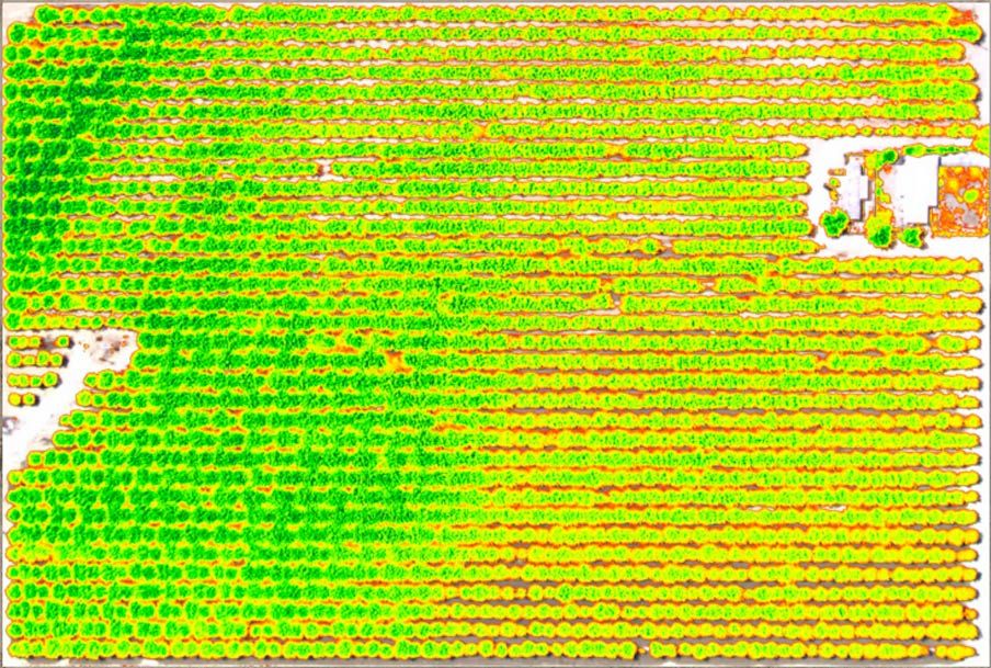
Our drone mounted multispectral camera allows aerial crop analysis using the Normalised Difference Vegetation Index (NDVI) as an index of photosynthetic activity and plant health.
Healthy plants with high levels of photosynthesis absorb more red light while vegetation that is stressed reflects red light. The resulting NDVI image shows where additional fertiser is required. Other applications resulting in higher yields and less waste include:
- Plant coverage & density detection;
- Frost damage detection;
- Large scale pest outbreaks;
- Optimising crop rotation durations; and
- Soil moisture content.