
Aerial Surveys
UAV Drone Aerial Surveys
The central benefit of adopting UAV technology within the construction industry is to advance our understanding of the natural & built environments in order to better inform the associated decision-making process. UAVs are able to deliver this in a rapid and cost-effective way.
Experts at Collecting Aerial Survey Data
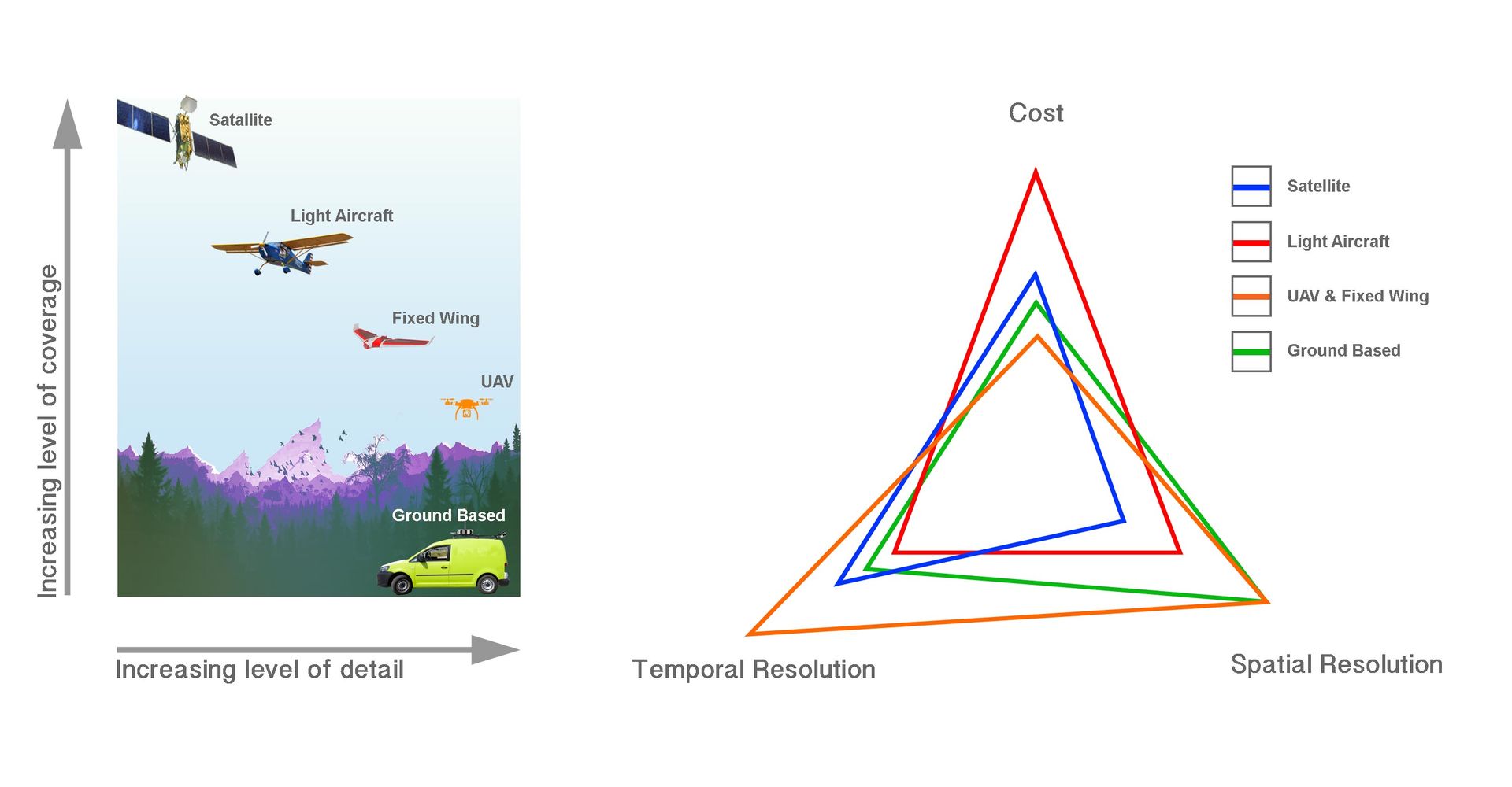
UAVs operate between our human scale of landscape observation and that of low-flying aircraft, that is between ground level & 120m. When combined with appropriate receptors to record survey data and the software to process it, this combination hits the ‘sweat-spot’, quickly capturing and processing cost-efficient, high quality, survey data.
UAV systems
are relatively inexpensive to commission, and with the low ground sample distance (GSD) of c.1cm/pixel (Inspire 1 Pro at 50m) they can be deployed rapidly giving a high temporal resolution (time in between repeat surveys). When utilised with photogrammetry software, even mid-range UAV systems can out perform other techniques in their ability to generate high-resolution topographic data for use in topographical surveys, 2D and 3D modelling, flood risk assessment, habitat surveys, and many additional applications.
Benefits of Remote UAV Aerial Surveying
- High spatial resolution data;
- Ability to target small areas at virtually any time;
- Geo-referenced data facilitates measurement of small changes;
- Non-intrusive method of acquiring data;
- Improved efficiency and effectiveness of ground surveys;
- Access to remote / inaccessible areas;
- Not impeded by cloud cover; and
- Reduced health and safety risk.
UAV Technology - Innovate, Integrate & Initiate
The last decade has seen the exponential development of UAV technology to the point that UAV’s, and the array of associated software, now offer a stable, reliable & tested platform that offers many benefits and applications within the construction industry. As is the way with innovative technology, the pace of change and innovation is fast. We can help you integrate & initiate the use of innovative UAV technology within your business.
Please
contact us for a friendly, no obligation discussion about how a drone survey can be beneficial to your project or to arrange for a site visit.